|
| *****SWAAG_ID***** | 83 |
| Date Entered | 12/01/2011 |
| Updated on | 22/08/2012 |
| Recorded by | Tim Laurie |
| Category | Burnt Mound |
| Record Type | Archaeology |
| Site Access | Army Range |
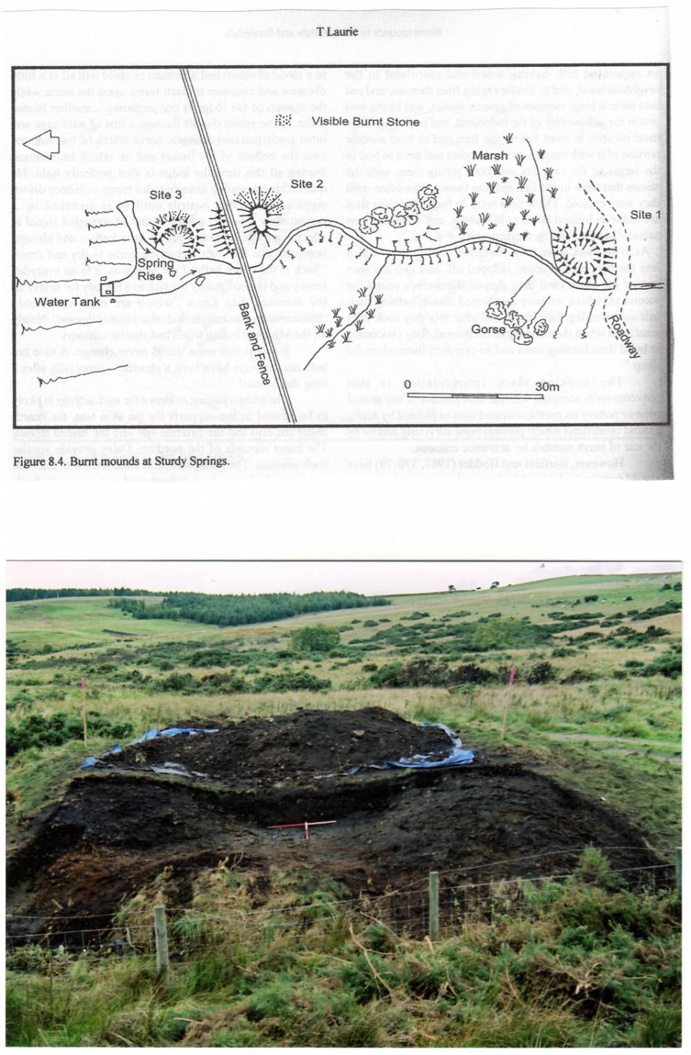
| Location | WHASHTON C.P. Sturdy Springs, four burnt mound sites. |
| Civil Parish | Whashton |
| Brit. National Grid | NZ 135 052 |
| Altitude | 258m |
| Geology | Braided Springs and small streams rising below the outcrop of the Underset Limestone on the Feldom Fault. |
| Record Name | WHASHTON C.P. Sturdy Springs, four burnt mound sites. One site excavated and radiocarbion dated, one site radiocarbon dated. |
| Record Description | On the army range. One isolated site and three sites on banks of same spring stream, the two uppermost are close together on the west bank of the spring, the lower site is 100m down stream, in front of the grenade range. The first of these sites to be discovered was by by Paul Brown. Middle site, very large 15m * 12m and <2m high.
#Site 1, middle site NZ 1351 0519 Large, high.
#Site 2, upper site NZ 1350 0516 Large, average.
#Site 3, lower site NZ 1348 0527 Large, average. Excavated by The University of Durham.
Indicative Dimensions.
Size: Small <6m, Medium 6m-9m, Large 10m-15m, Extra large >15m.
Height: Low <0.5m, Average 0.5-1.0m, High >1.0m. |
| Dimensions | #Site 1, middle site NZ 1351 0519 Large, high. |
| Additional Notes | Sturdy Springs, burnt mound radiocarbon dates:
Site 1. lowest site. excavated. Radiocarbon dated from charcoal in fill to trough to 1430-1260BC
Site 3. Top site, unexcavated. Radiocarbon dated from hazel chacoal collected from side of rabbit burrow to 2400-2140BC |
| Image 1 ID | 171 Click image to enlarge |
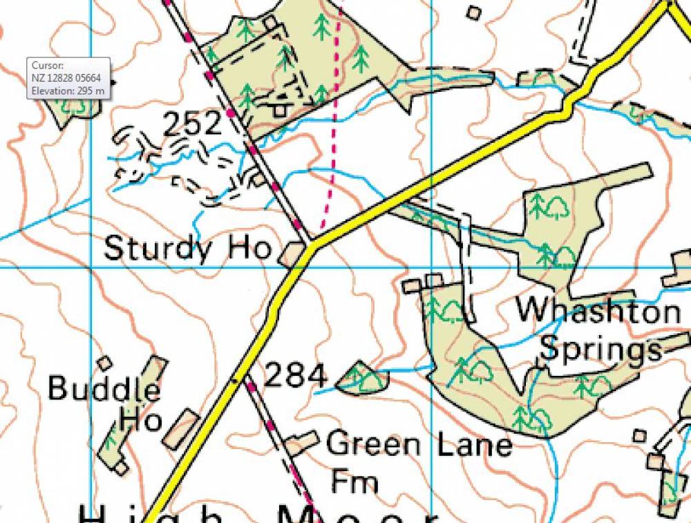
| Image 1 Description | OS Map of the area | 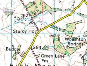 |
| Image 3 ID | 206 Click image to enlarge |
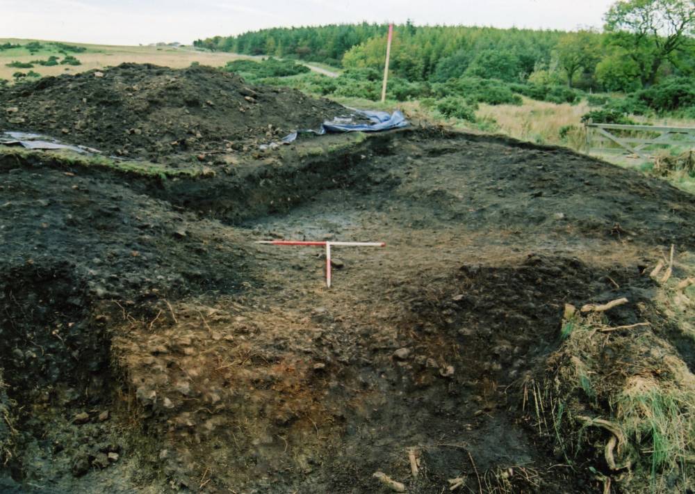
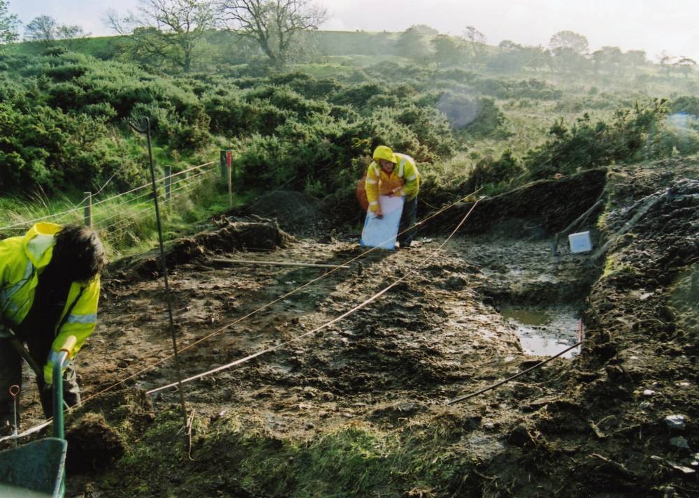
| Image 3 Description | Sturdy Springs Burnt Mound Site 1 under excavation | 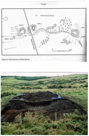 |
| Image 4 ID | 207 Click image to enlarge |
| Image 4 Description | Sturdy Springs Burnt Mound Site 1 under excavation |  |
| Image 5 ID | 208 Click image to enlarge |
| Image 5 Description | Sturdy Springs Burnt Mound Site 1 under excavation |  |
| Image 6 ID | 209 Click image to enlarge |
| Image 6 Description | Sturdy Springs Burnt Mound Site 1 under excavation | 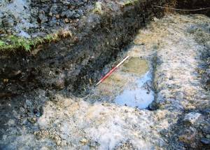 |
| Image 7 ID | 210 Click image to enlarge |
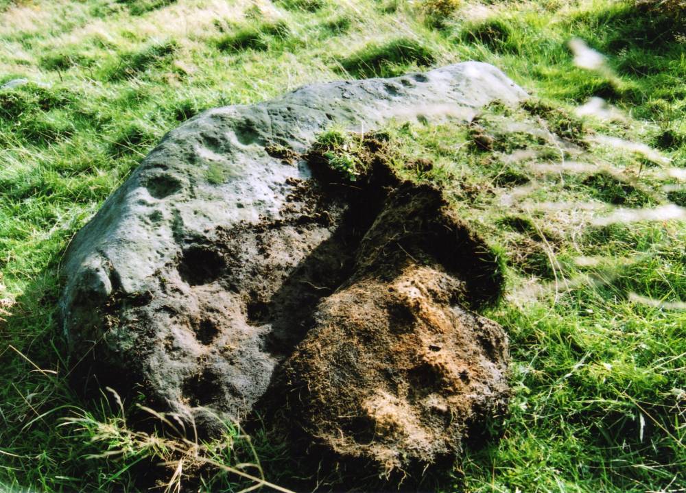
| Image 7 Description | Sturdy Springs. Cup and ring marked rock 500m sw of Burnt Mounds | 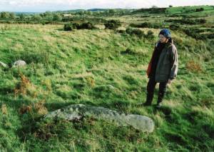 |
| Image 8 ID | 211 Click image to enlarge |
| Image 8 Description | Sturdy Springs. Cup and ring marked rock 500m sw of Burnt Mounds | 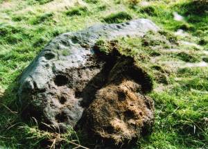 |